

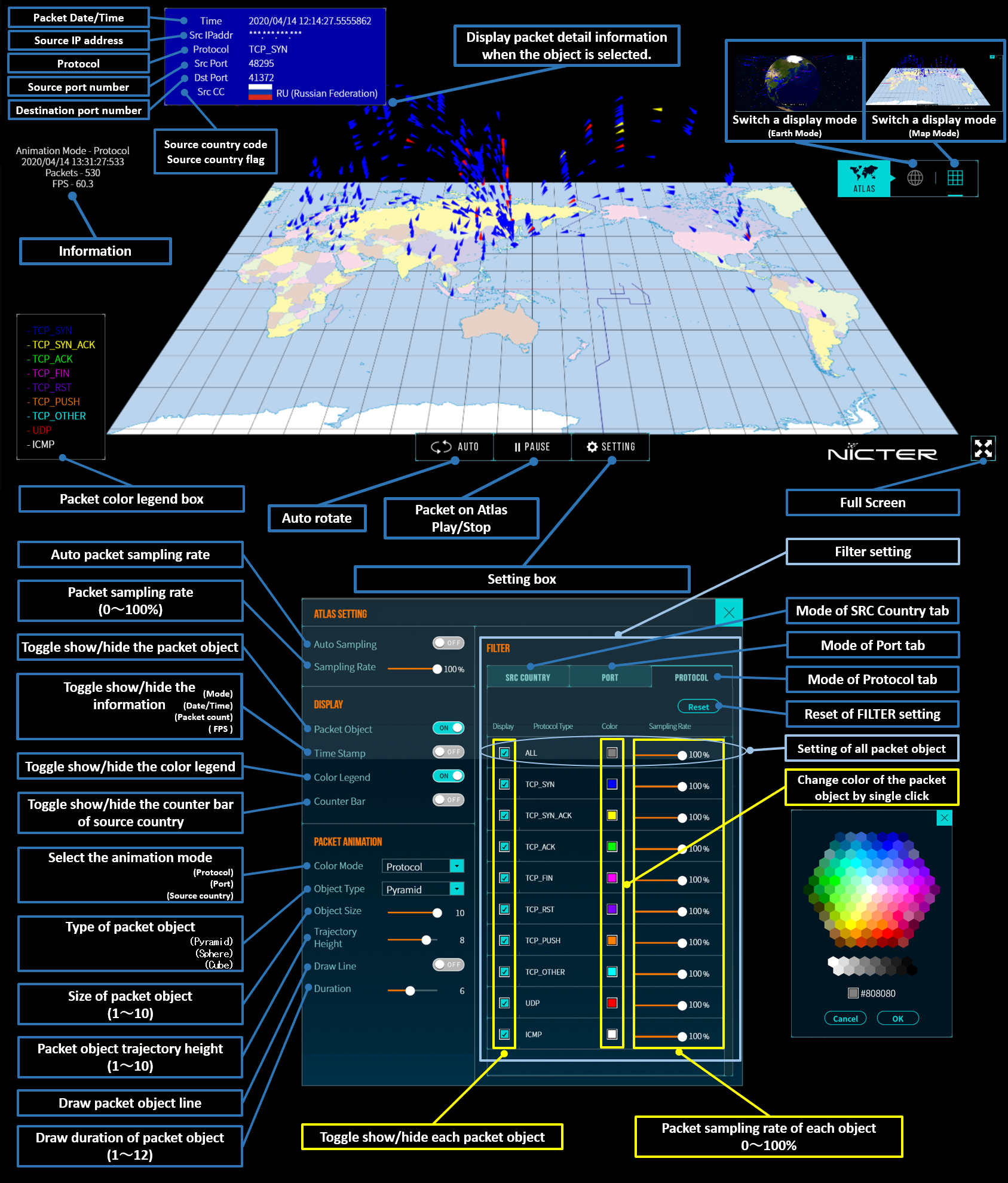
Atlas is a real-time visualization engine that visualizes packets arriving at NICTER's darknet sensors on a world map. The origin of the animated packet on the map represents the country where the source IP address belongs. The hight of the packet's trajectory is proportional to the port number in logarithmic scale. The trend of scanning activity of botnet or of those organized network scan may be identified through the visualization.
Credit
NASA Goddard Space Flight Center Image by Reto Stöckli (land surface, shallow water, clouds). Enhancements by Robert Simmon (ocean color, compositing, 3D globes, animation). Data and technical support: MODIS Land Group; MODIS Science Data Support Team; MODIS Atmosphere Group; MODIS Ocean Group Additional data: USGS EROS Data Center (topography); USGS Terrestrial Remote Sensing Flagstaff Field Center (Antarctica); Defense Meteorological Satellite Program (city lights).
Atlas User's Guide
Copyright © National Institute of Information and Communications Technology. All Rights Reserved.